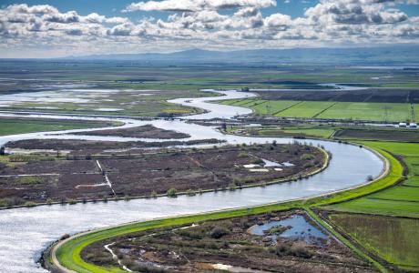
Watch our series of short videos on the importance of the
Sacramento-San Joaquin Delta, how it works as a water hub for
California and the challenges it is facing.
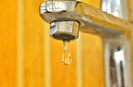
Some people in California and across the West struggle to access
safe, reliable and affordable water to meet their everyday needs
for drinking, cooking and sanitation.
There are many ways to support our nonprofit mission by donating
in someone’s honor or memory, becoming a regular contributor or
supporting specific projects.
As atmospheric rivers blasted across California this year, they
brought epic amounts of rain and snow follwing a three-year
drought.
Devastating and deadly floods hit parts of the state and now all
eyes are on the potential for more flooding, particularly in
the San Joaquin Valley as the record amount of snow in the
Sierras melts with warmer temperatures.
With anticipated sea level rise and other impacts of a changing
climate, flood management is increasingly critical in California.
As we head into summer, don’t miss your chance to explore the
statewide impact of forest health on water resources in July and
be sure to mark your calendars for our popular fall programming!
Northern
California Tour, October 16-18: Explore the
Sacramento River and its tributaries through a scenic landscape
while learning about the issues associated with a key source
for the state’s water supply. Registration opens June
12!
Water Summit, October 30: Attend the Water
Education Foundation’s premier annual event hosted in
Sacramento with leading policymakers and experts addressing
critical water issues in California and across the West. More
details coming soon!
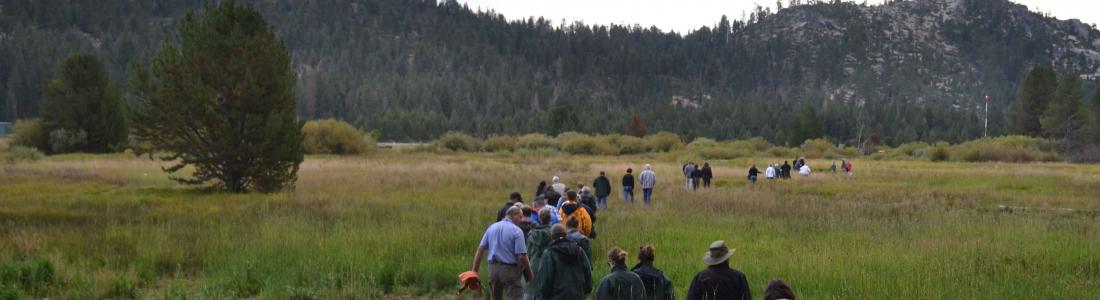
Headwaters Tour: July 24-25
Venture with experts into the
foothills and mountains of the Sierra Nevada to examine water
issues that happen upstream but have dramatic impacts on water
supply and quality downstream and throughout California on our
Headwaters Tour July
24-25!
With more than half of the state’s developed water supply
originating high in the Sierra Nevada,
millions of Californians are affected by the health of
our forests. Despite a few wet years, forests are suffering
from multi-year droughts and historically intense
wildfires.
The 2-day, 1-night tour starts and ends in Sacramento and
travels up the American River watershed, around Lake Tahoe
(where we stay overnight) and down the Yuba River watershed.
Space is more limited on this tour than any other that we
host, soreserve your seat on the bus
herewhile they last!
Mark Arax, an award-winning
journalist and author of books chronicling agriculture and water
issues in California’s Central Valley, will provide the keynote
talk at an international groundwater conference next month.
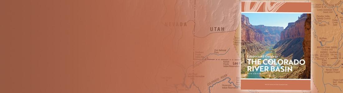
Southwestern Colorado is left with 6% of its peak snowpack
earlier than usual this season in part because of a rare,
sudden and large melt in late April. Snow that gathers in
Colorado’s mountains is a key water source for the state, and a
fast, early spring runoff can mean less water for farmers,
ranchers, ecosystems and others in late summer. While the snow
in northern Colorado is just starting to melt, southern river
basins saw their largest, early snowpack drop-off this season,
compared to historical data. For Ken Curtis, the only reason
irrigators in Dolores and Montezuma counties haven’t been short
on water for their farms and ranches is because the area’s
reservoir, McPhee Reservoir, had water supplies left over from
the above-average year in 2023. “Because of the carryover, the
impacts aren’t quite that crazy bad,” said Curtis, general
manager of the Dolores Water Conservancy District.
Above-average storms have allowed the Modesto Irrigation
District to offer Tuolumne River water to nearby farmers who
normally tap wells. It is getting few takers. The program is
designed to boost the stressed aquifer generally east of
Waterford, just outside MID boundaries. The district board on
Tuesday debated whether to drop the price to spur interest, but
a majority voted to leave it unchanged. The discussion came
amid a state mandate to make groundwater use sustainable by
about 2040. MID does not have a major problem within its
territory, which stretches west to the San Joaquin River. But
it is part of a regional effort to comply with the 2014 law.
This includes out-of-district sales of Tuolumne water in years
when MID’s own farmers have plenty. That was the case in 2023,
one of the wettest years on record, and this year thanks to
storage in Don Pedro Reservoir.
California’s Clear Lake has been taken over by so much algae
that its emerald waters are now visible from space, photos
show. The satellite images, taken by NASA in mid-May,
indicate that the eutrophic lake may be infested with
blue-green algae, or cyanobacteria — single-celled
organisms that can become potent enough to poison humans
and animals, according to the United States Geological
Survey. County officials wrote that, overall, algae
is integral to the freshwater lake’s health and aquatic
ecosystem. More than 130 different types of species have been
identified thus far, but three problematic blue-green algal
species have been known to bloom there in the spring and late
summertime. These harmful species can cause skin irritation,
along with gastrointestinal and neurological symptoms,
officials said.
As we head into summer, don’t miss your chance to explore the
statewide impact of forest health on water resources
on our Headwaters Tour July
24-25! We’ll venture with experts into
the foothills and mountains of the Sierra Nevada to examine
water issues that happen upstream but have dramatic impacts on
water supply and quality downstream and throughout California
on our
Save the dates for:
Northern
California Tour, October 16-18: Explore the
Sacramento River and its tributaries through a scenic
landscape while learning about the issues associated with a
key source for the state’s water supply. Registration
opens June 12!
Water Summit, October 30: Attend the Water
Education Foundation’s premier annual event hosted in
Sacramento with leading policymakers and experts addressing
critical water issues in California and across the West. More
details coming soon!
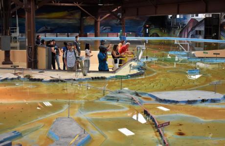
Operated by the U.S. Army Corps of Engineers, the
Bay Model is a giant hydraulic replica of San Francisco
Bay and the Sacramento-San Joaquin
Delta. It is housed in a converted World II-era
warehouse in Sausalito near San Francisco.
Hundreds of gallons of water are pumped through the
three-dimensional, 1.5-acre model to simulate a tidal ebb
and flow lasting 14 minutes.
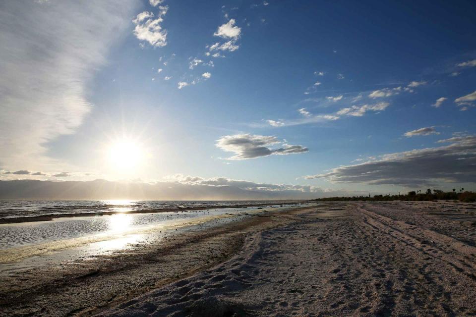
As part of the historic Colorado
River Delta, the Salton Sea regularly filled and dried for
thousands of years due to its elevation of 237 feet below
sea level.
The most recent version of the Salton Sea was formed in 1905 when
the Colorado River broke
through a series of dikes and flooded the seabed for two years,
creating California’s largest inland body of water. The
Salton Sea, which is saltier than the Pacific Ocean, includes 130
miles of shoreline and is larger than Lake Tahoe.
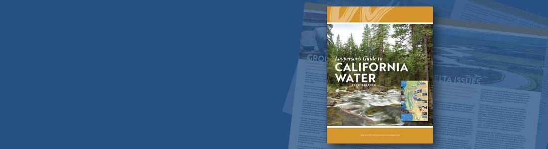
Drought—an extended period of
limited or no precipitation—is a fact of life in California and
the West, with water resources following boom-and-bust patterns.
During California’s 2012–2016 drought, much of the state
experienced severe drought conditions: significantly less
precipitation and snowpack, reduced streamflow and higher
temperatures. Those same conditions reappeared early in 2021
prompting Gov. Gavin Newsom in May to declare drought emergencies
in watersheds across 41 counties in California.